

Day 10: Gorak Shep to Kala Patthar (5/14)
Trip Duration: 3+ hours
Elevation at Gorak Shep: 5,180 meters (16,995 feet)
Elevation at Kala Patthar: 5,643 meters (18,514 feet)
Elevation Gain: 463 meters (1,519 feet)
Distance: 3.7 km ( 2.3 miles )
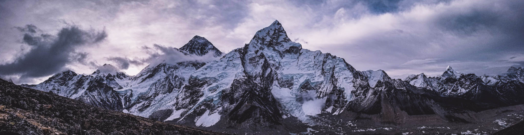
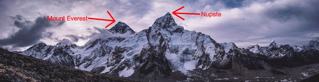
Beside the town of Gorak Shep lies a large black hill called Kala Patthar (meaning black rock). The view from the summit of Kala Patthar is said to be an even more amazing view than from Mount Everest Base Camp. So I was looking forward to experiencing both.
The best time to hike Kala Patthar is around sunrise for the most majestic views. This required me to to get up at 4:00 am, while it was still dark and also extra nice and frigid.
Mt. Everest Base Camp Trek 101: Summiting Kala Patthar is best during sunrise where you can usually get the clearest and best views of Mount Everest.
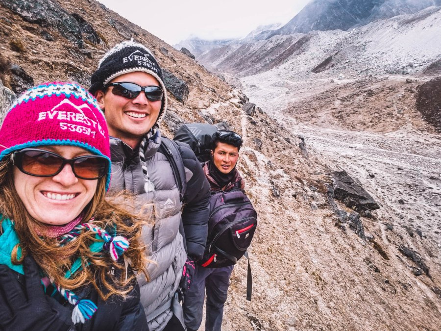
Luckily, Govinda (our guide and sherpa) was extra persistent which helped me get up and out the door.
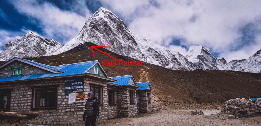
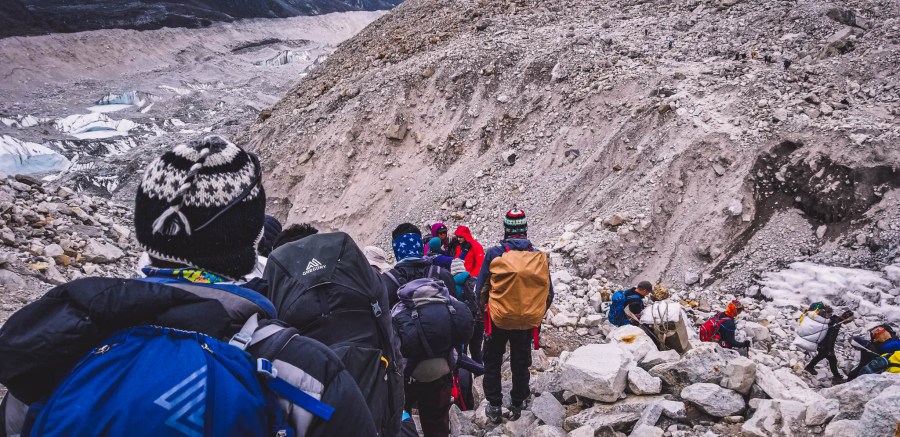
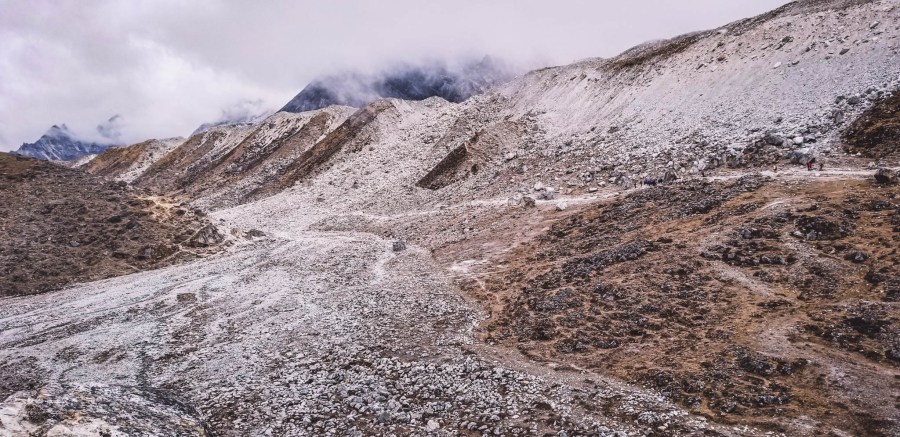
We headed out into the darkness with headlamps on and began our trudge up the scree-covered hill. Luckily, the path was decently paved, but this hike was definitely difficult. Gaining over 1,500 feet from 16,995 feet to 18,514 feet was no joke and the ascent took us about 1.5 hours (one-way) to summit. Here are several photos along the route:
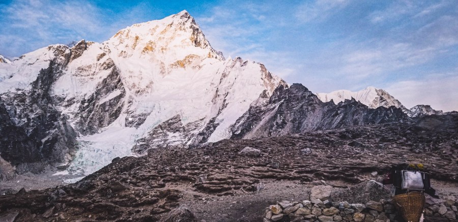
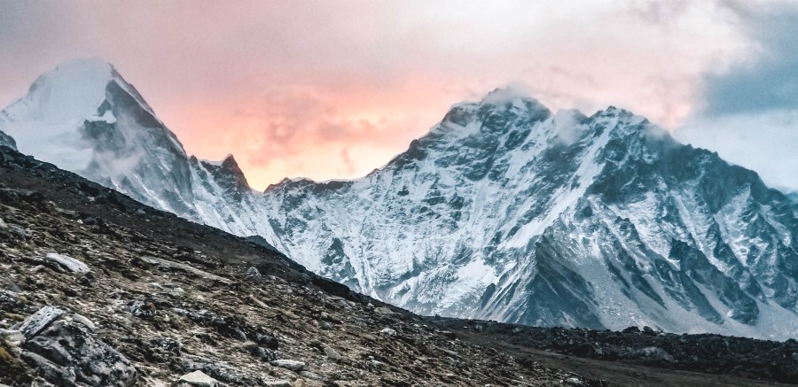
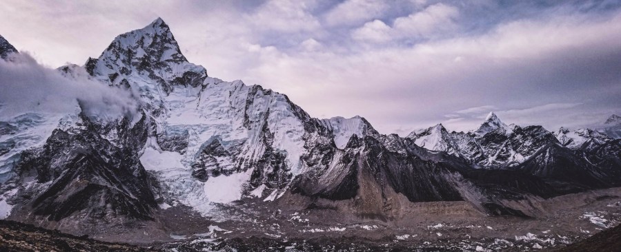
Here are some of the photos along the way:

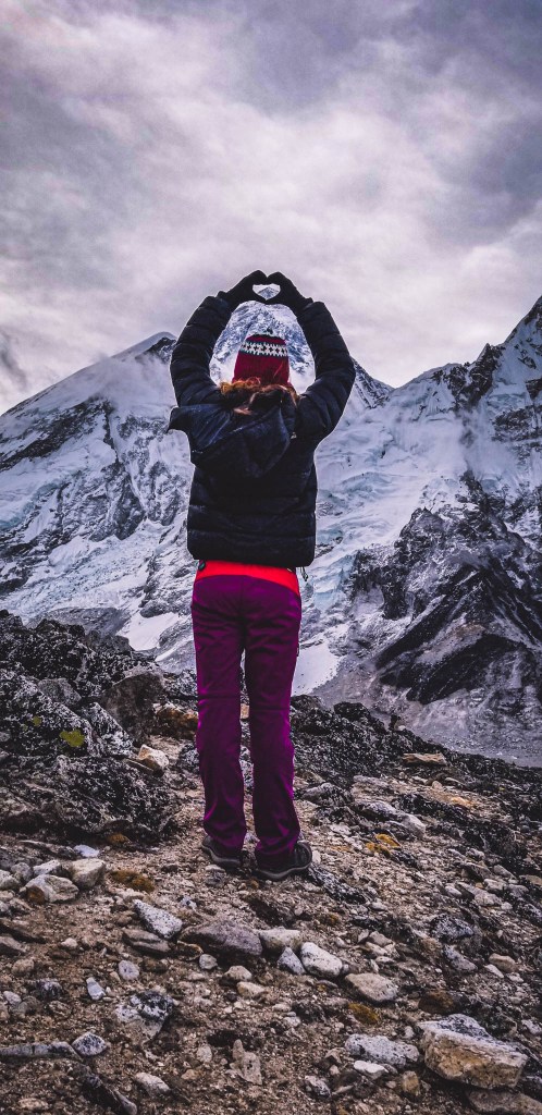
When we got to the top I very cautiously walked out to the tip and looked over in amazement, it was breathtaking and spine-chilling. Behind me was a drop-off, I was shaking in excitement and fear.
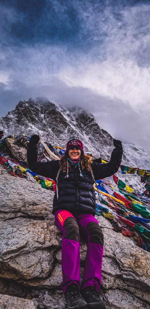
Several people say that the view from Kala Patthar is the best view you can get of Mount Everest excluding the route from summiting or using substantial mountaineering skills. I can now say that from my experience, I agree with these people.
After spending some time enjoying the views and reveling in the accomplishment it was time to head back down into town to grab some breakfast and check on Kurt and make sure he was alive.
You may have been wondering where my partner in crime was during this hike. Unfortunately, Kurt’s “Khumbu Cough” was pretty severe the couple days before and previous night, so much that his ribs were hurting from coughing so much. He also wasn’t sleeping/feeling well and felt that he might get really sick if he woke up for an early morning hike in the cold. He also may have been experiencing some minor AMS (acute mountain sickness). So he decided he didn’t want to risk it.
TREKKING 101: It is important to keep in mind if EVER you are experiencing harsh symptoms of AMS (including extreme fatigue, dizziness, nausea and vomiting etc) you should immediately descend.
Gorak Shep to Dzongla (Day 10 Continued)
Trip Duration: 5 hours
Elevation at Gorak Shep: 5,180 meters (16,995 feet)
Elevation at Dzongla: 4,830 metres (15,850 feet)
Elevation Loss: -350 meters (1,145 feet)
Distance: 10.8 kilometers (6.7 miles)
After the descent of Kala Patthar we found Kurt feeling better and thankful for the extra needed sleep. He was ready to continue our trek now heading towards Gokyo. If you recall from our earlier posts, we had initially planned on taking the classic Everest Base Camp Trek which would have had us head all the way back down the mountains taking the same path we took the previous nine days, but after talking with several people we opted to add Gokyo to our itinerary because of the stunning views from Gokyo Ri including huge lakes and more epic views of the Himalayas.
The hike from Gorak Shep to Dzongla took us back through Lobuche (day 8) and further along the return trail until we reached a split in the path where we proceeded to take route to Dzongla. From here on to the end it was all new territory.
The hike from Gorak Shep to Dzongla is one of the easier/short routes we had taken. There is actually a net elevation loss between the two destinations. Expect to see a lot of barren rocky terrain along this part of the trek.

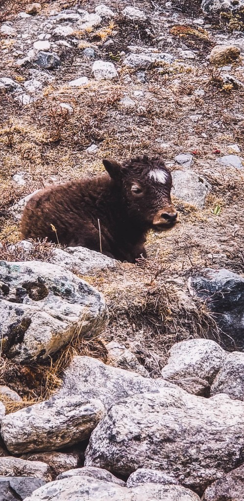
The area of Dzongla is a common place to spot some high-altitude birds, if you are lucky to spot them, which we were.

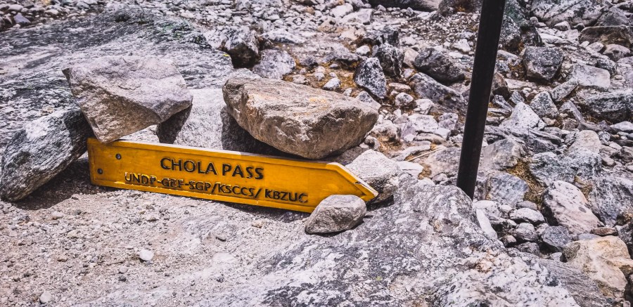
After 4-5 hours of hiking we reach Dzongla which sits at the base of the Cho La Pass and connects the main Everest Base Camp trekking path to the Gokyo region.
Accommodation
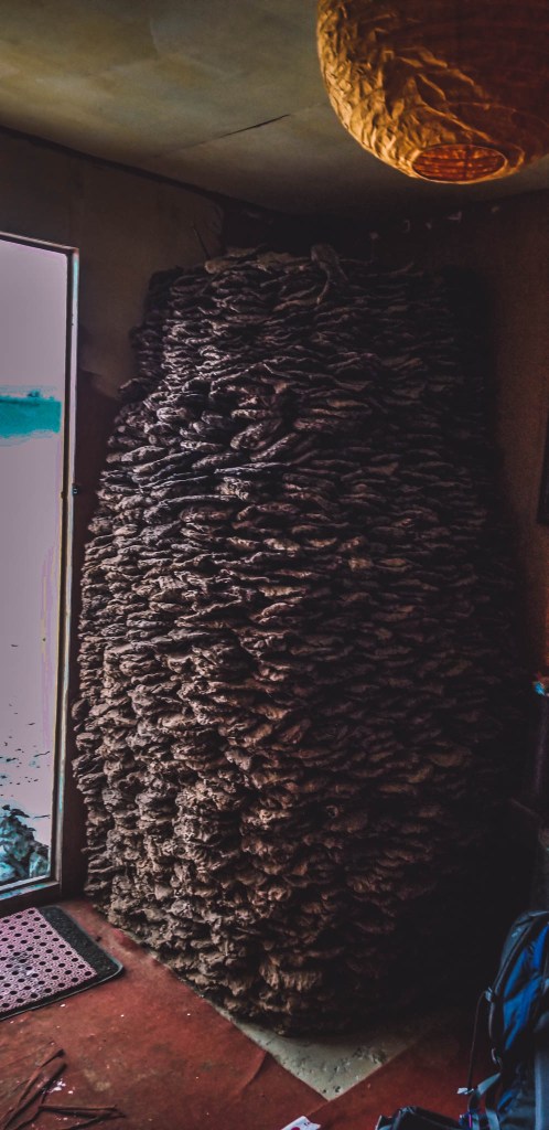
The accommodation was pretty standard, but this time we were greeted by the biggest stack of yak pies (yak poo) we’d ever seen. And boy were we never happier, it was a cold trek and we were happy to know we were going to get warmed up by a fire with yak dung.
The next morning we would begun our trek through the Chola Pass which had more unique and unbelievable landscapes.
