

Day 8: LOBUCHE TO GORAK SHEP (5/12)
Trip duration: 4 hours
Elevation at Lobuche: 4,940 meteres (16,207 feet)
Elevation at Gorak Shep: 5,180 meters (16,995 feet)
Elevation Gain: 240 meters (787 feet)
Distance: 4.3 km ( 2.6 miles)
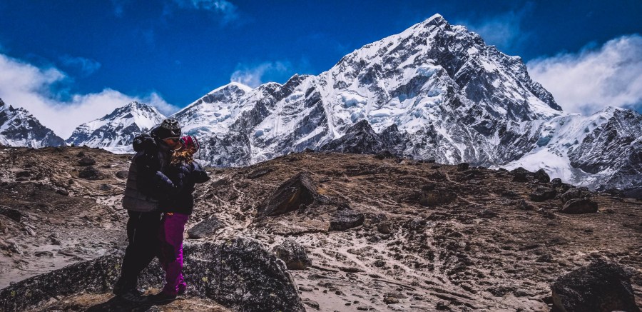
After one night’s rest in Lobuche, we woke up the next morning to trek to Gorak Shep, the northernmost village along the classic EBC trek. We had originally planned to trek to Gorak Shep, then to Base Camp, and then return to sleep in Gorak Shep all in the same day. However based on several factors such as not sleeping well the night before, waking up later than planned, our “Khumbu coughs” getting pretty bad, and weather conditions we decided to cut this day short and stop at Gorak Shep rather than continuing on to EBC. Most people will start to exhibit altitude sickness symptoms after 5,000 meters.
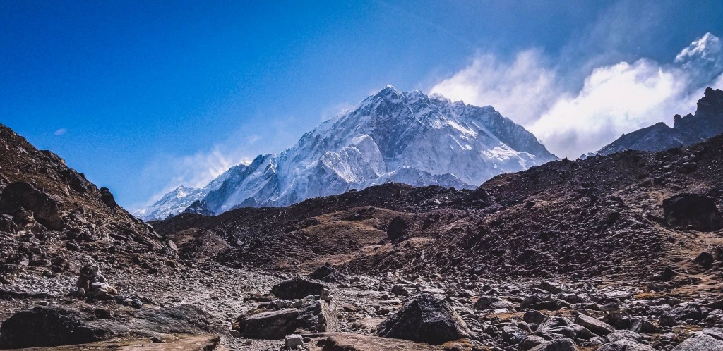
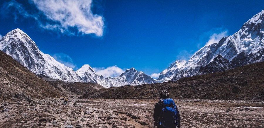
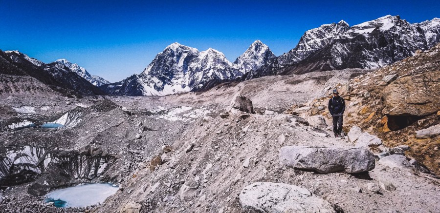
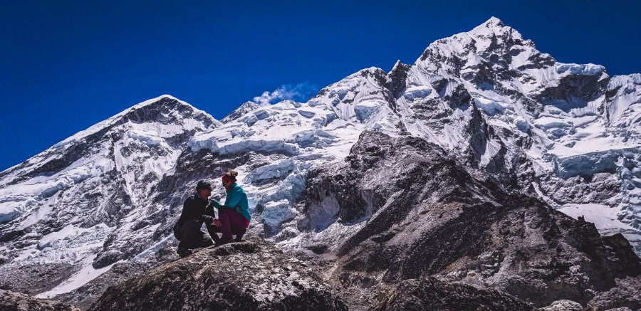
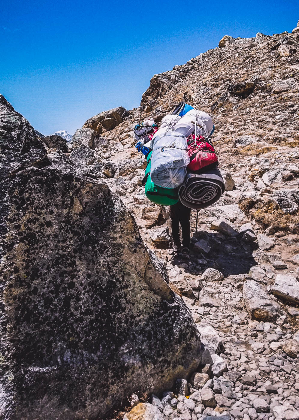
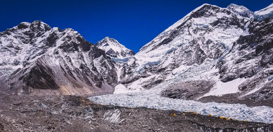
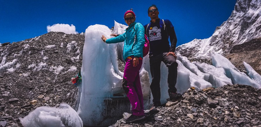
The trek brought us through wide barren rocky fields that had several amazing views of the snow capped Himalayas. We traveled up, down and around a well-traveled dirt trail around the rubble that has accumulated from the nearby mountains and glaciers. The whole EBC trek is a unique experience as you start in a more lush environment with flora including the rhododendron trees and gradually work you way up to habitats where plants can’t grow. Gorak Shep translates to “Dead Ravens” as the area lacks any vegetation.The rocky fields were a sights to see as well.
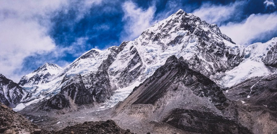
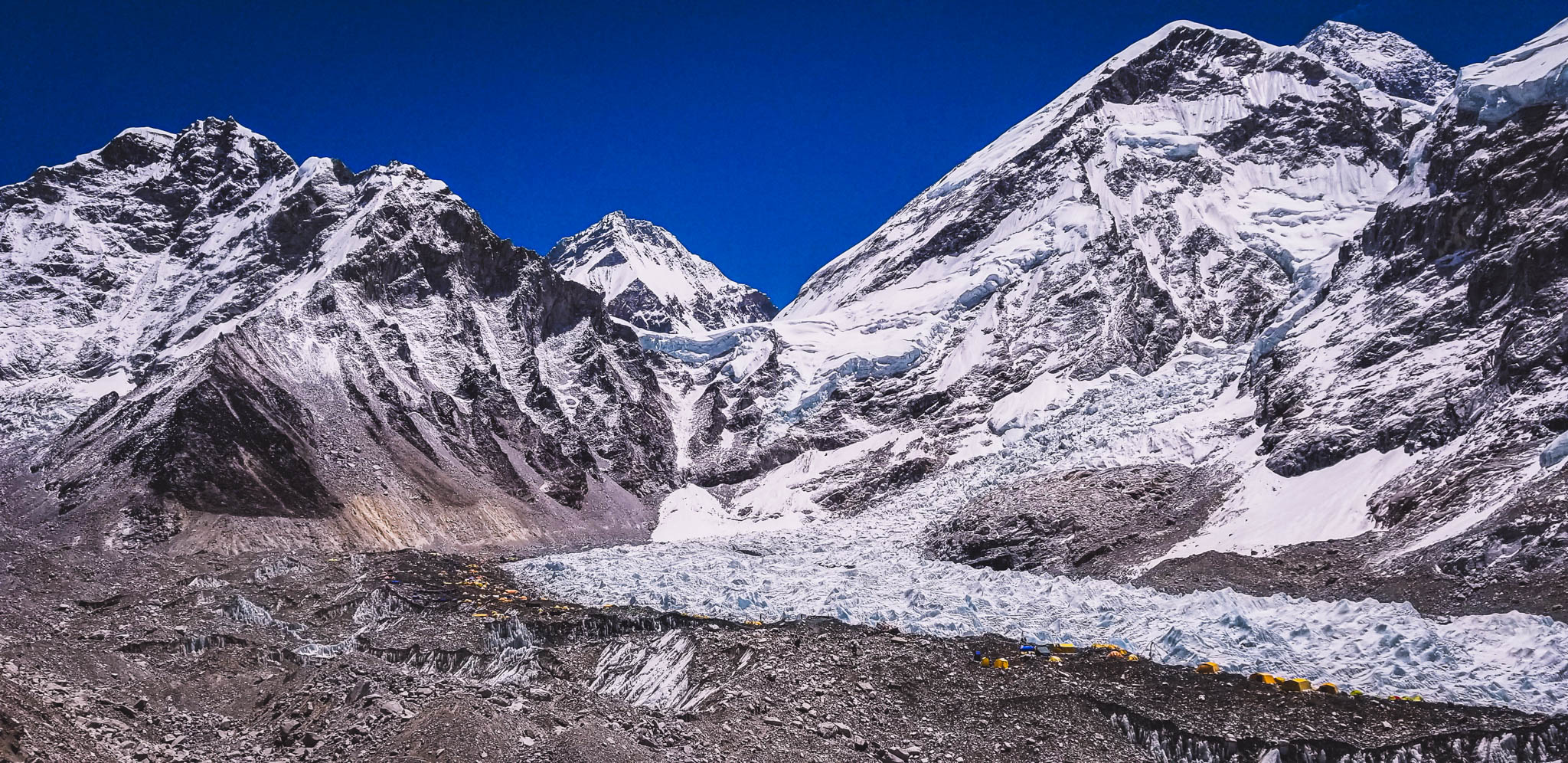
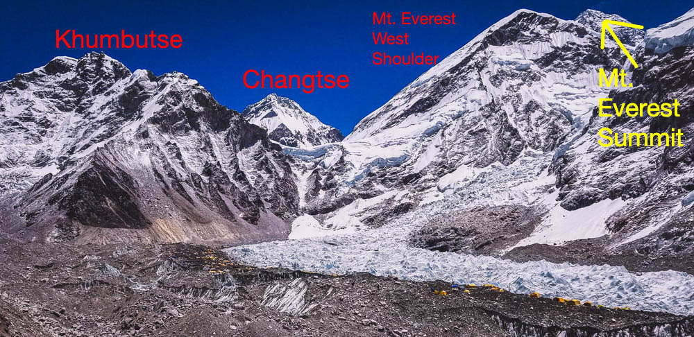
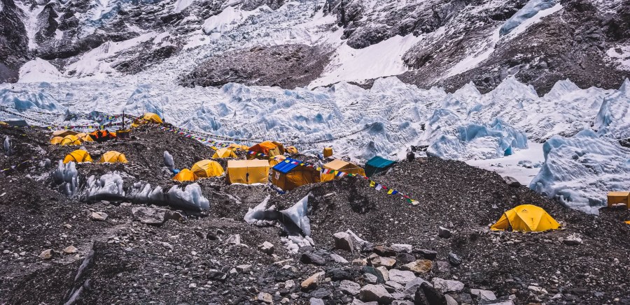
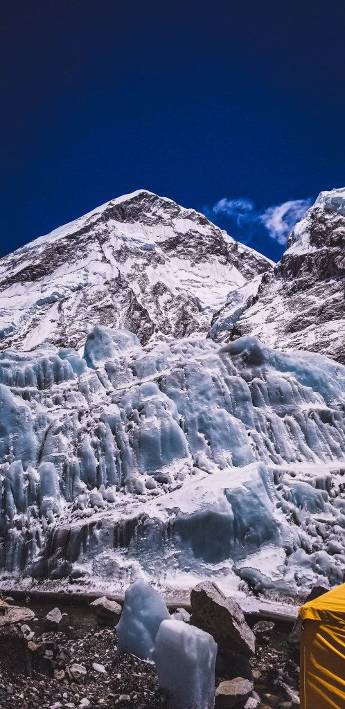
Another highlight along the route was views of the Khumbu Glacier. This glacier is the most dangerous in the world as it constantly moves as much as 3 feet per day, making it one of the most dangerous parts of summiting Mount Everest. Summiteers must first pass the Khumbu Icefall to get to their camps along the trek. The Glacier begins along the Gorak Shep trail and stretches into Mount Everest at an incredible height of 7,600 m (24,934 ft).
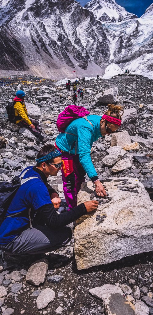
Overall, there was a lot of flat paths along the route which allowed for easier trekking in the thin air. However, there were some inclines that made the hike challenging due to once being higher in elevation than any of the previous days. This trek can be done in under 3 hours, but we took longer for several breaks and picture stops. The region is very stunning so we did not want to rush.
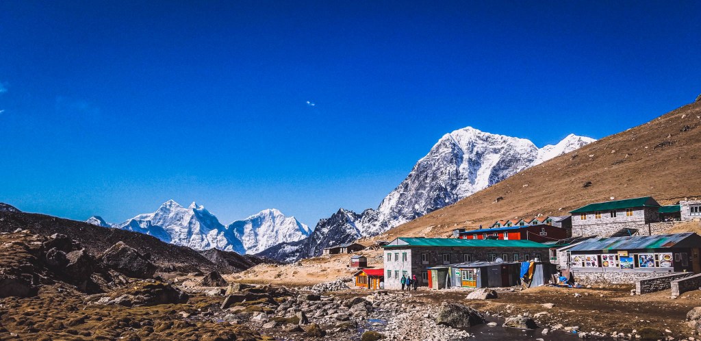
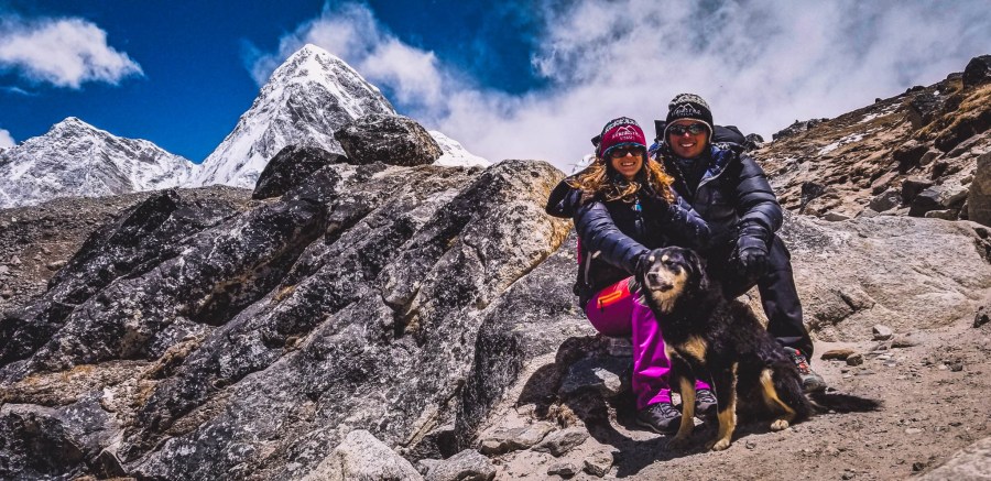
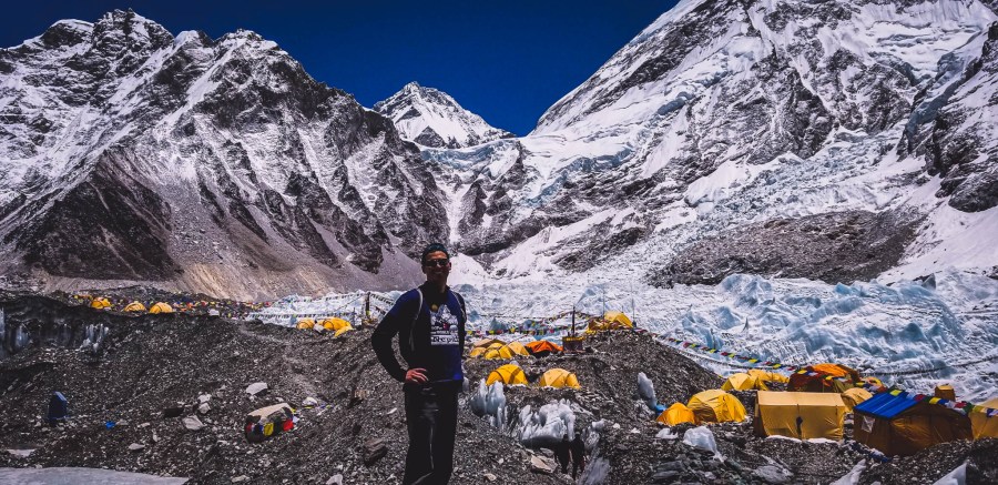
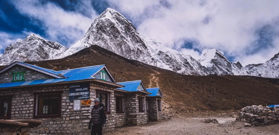
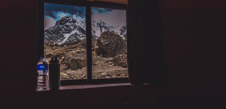
Upon arrival we checked into our tea house. This would be the highest point we would sleep at along the EBC (Everest Base Camp) trail and it is also the closest village to Everest Base Camp. Shortly within the first few days of our trek, we agreed in Namche we would add a trek to Gokyo Ri where we would be sleeping at elevation higher than at Gorak Shep.
Day 9: GORAK SHEP TO EVEREST BASE CAMP TO GORAK SHEP (5/13)
Trip duration: 5 hours
Elevation at Gorak Shep: 5,180 meters (16,995 feet)
Elevation at Everest Base Camp: 5,365 meters (17,601 feet)
Elevation Gain: 185 meters (606 feet)
Distance: 7.2 km (4.5 miles)
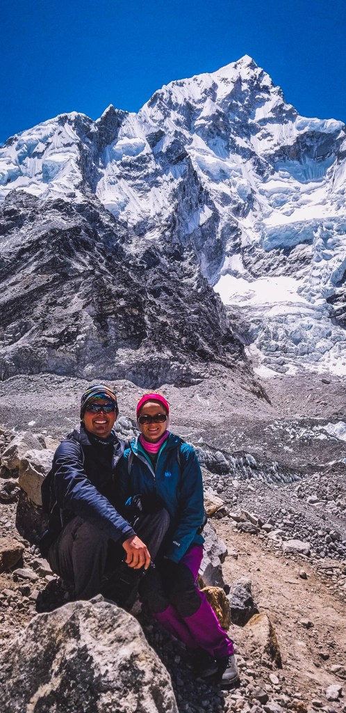
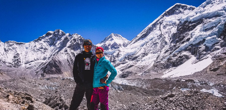
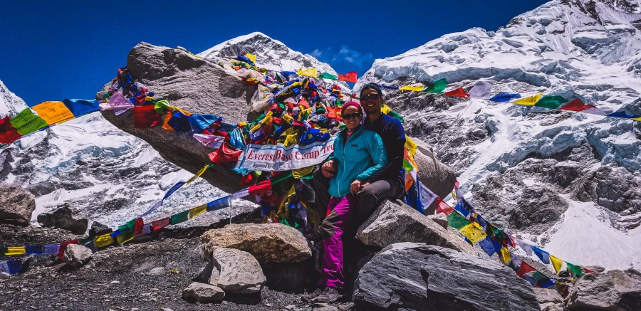
THE DAY WAS FINALLY HERE! EVEREST BASE CAMP! We woke up with an extra level of excitement in anticipation of finally reaching our goal.
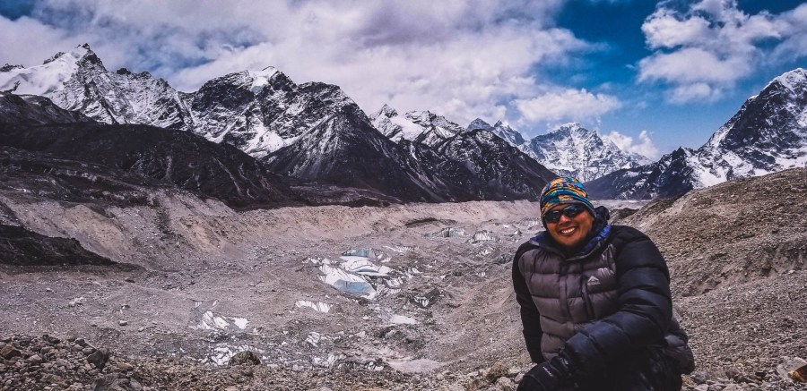
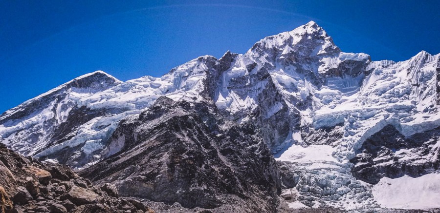
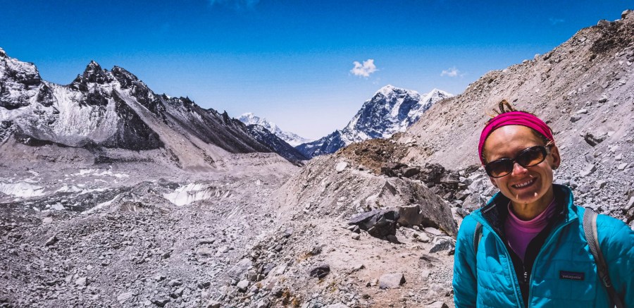
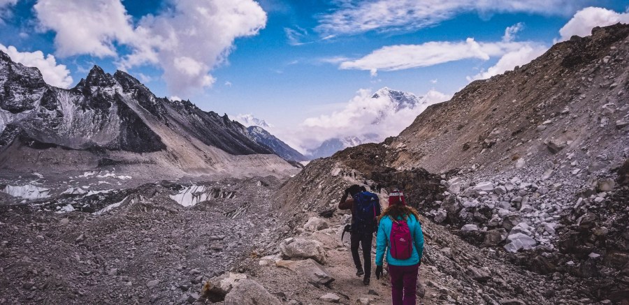
The landscape and scenery along this trail is some of the most beautiful we have ever seen. We passed through more rolling terrains of rock and boulders and had gorgeous views of the snowcapped mountains that now seemed right on top of us. Like we could actually get to Everest (even though it was still very far away).
The trail along this route has a gradual incline with not too much elevation gain (thank goodness). That way we were able to enjoy the views without being too winded. In addition to the rocky terrain, and mountains, we also enjoyed seeing the occasional frozen pools of water dotting the landscape.
We also enjoyed views of the Khumbu Glacier which sits at the base of Mount Everest and is the world’s highest glacier stretching up the mountain to heights of 7,600 m (24,934 ft).
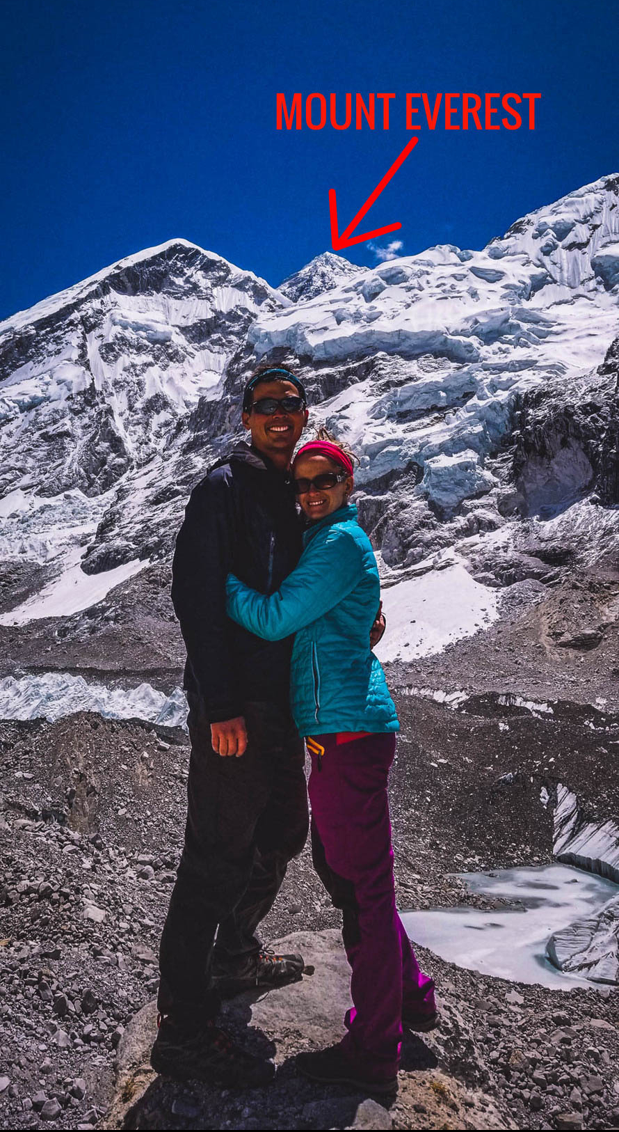
After less than 2 hours of hiking including several photo breaks we reached the entrance to Everest Base Camp. This was a big milestone, after 9 days of trekking over 70 km (43 miles) we successfully arrived.
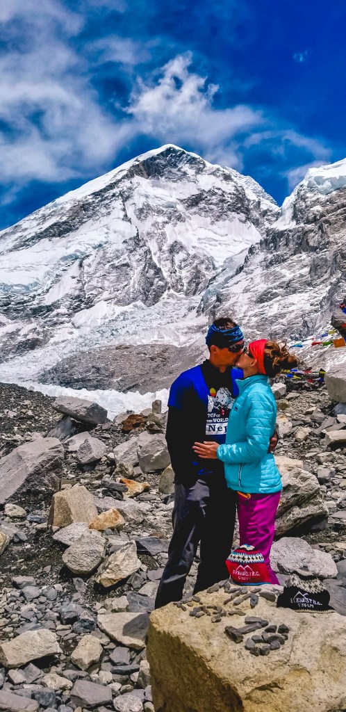
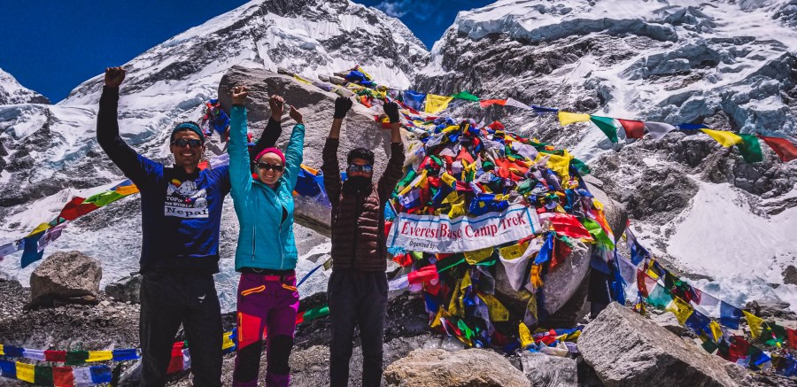
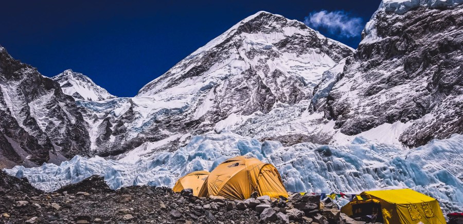
After taking our victory photos in front of the Everest Base Camp markers we began to explore the camp. It was cool seeing all of the yellow tents scattered along the camp and along the icefall. These brave souls were preparing for their ascent to the top of the World’s Highest Mountain.
While we were exploring the camp, we asked around to see if anyone could point us in the direction of a hiker we met on Day 2 of our trek who was planning on summiting. We were able to find his tent, however, we never tracked him down. Hope you made it to the top David!

Also, while walking around the village, we got the pleasure of meeting a mountaineer from Poland (my motherland) who was going to be advancing to summit Mount Everest. He shared his amazing goal to reach the Seven Summits (the highest mountains on each of the seven continents. Best of luck to you, hope you reached the top(s)!

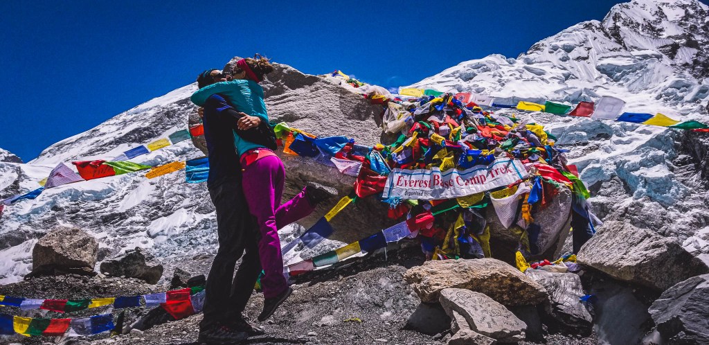
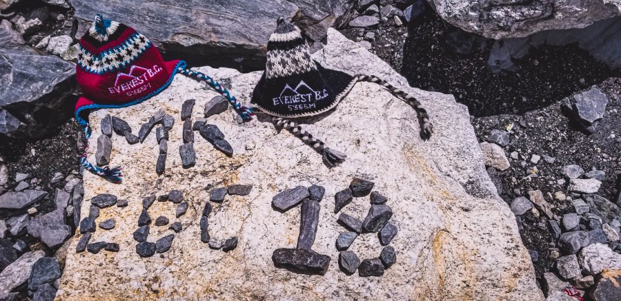
After exploring the village, we returned to the Everest Base Camp sign and decided to make a monument to commemorate our 9 day journey.
After saying our goodbyes we began the hike back to Gorak Shep which took us about 2 hours with breaks and covered 4.3 km or just over 2.5 miles. The day trek from Gorak Shep to EBC and back can easily be done in under 4 hours, but we spent a lot of time exploring this breathtaking area, talking with mountaineers that were going to attempt to summit Mount Everest, and taking lots and lot of pictures.
Accommodation
We stayed at Himilayan Lodge and Restaurant where they had a nice fire burning for their guests. The fire was much needed after a couple of cold days trekking. Expect prices of accommodation, food, usage of electricity, etc to be higher considering you are higher than 5,000 meters in the mountains.
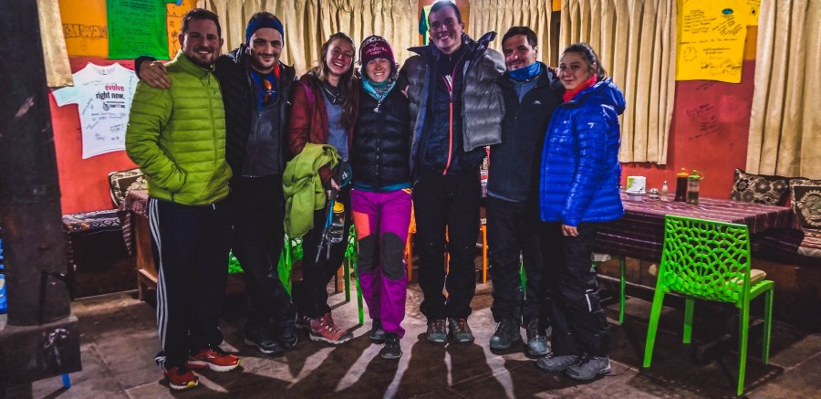
At night we played card games with friends we met along the trail. This was a really fun night for all of us.
The next day I (Marlena) reached the top of Kala Patthar, known as the best view (without mountaineering skills) of Mount Everest (and indeed it was).

Amazing views. Thanks for sharing and explaining.
LikeLiked by 1 person
Thanks Dan. Anytime! 😁 So happy you enjoy these incredible places.🤗
LikeLiked by 1 person